African Youth
Empowerment
& Development
AYED GHANA
Kyabobo and Shaire
GEOMORPHOLOGY OF SHIARE
GEOMORPHOLOGY
Shiare an area in the Oti region of Ghana is located in the Northeastern part of the country and is known for Its diverse geology. The region is characterized by a mix of Precambrian basement rocks and an overlying Tertiary rock.
The Precambrian rocks consist mainly of granite, gneiss, and schist. These rocks are thought to have formed during the Birimian and Tarkwaian orogenesis, which occurred between 2.5 and 1.5 billion years ago (ref: the tectonic stratigraphic relationships between the upper Precambrian and lower Paleozoic volta basin and the pan African dahomeyede orogenic belt (West Africa)). Granite is an extrusive igneous rock, whereas the gneiss and schist are metamorphic rocks formed from the alteration of the granite due to high pressure and temperatures causing the melting and solidification of the ancient crustal granitic rocks.
The Tertiary sedimentary rocks in the Oti region consist mainly of sandstones, shales, and limestones. These rocks were formed during the Eocene and Oligocene periods, which occurred between 34 and 23 million years ago (Ma).
GEOLOGY OF THE SHIARE AREA IN THE OTI REGION OF GHANA
GEOLOGY OF THE SHIARE AREA
Shiare is characterized by a series of landforms created by the action of erosion and depositional processes. The Precambrian rocks of the area (i.e., granite, gneiss, and schist) are relatively resistant to erosion and form the foundation of the area’s topography. The main landforms found in Shiare are the Inselbergs, these are isolated, steepsided hills that rise abruptly from the surrounding landscape. They are thought to have formed from the erosion of the surrounding softer Tertiary sedimentary rocks, leaving the more resistant Precambrian igneous and metamorphic rocks standing out.
In summary, the geomorphology of “Shiare” is characterized by landforms created by erosional, transportation and depositional processes. The Inselbergs, pediments, gorges, valleys and alluvial fans are the main landforms that makes the area’s topography stand out. Minor landforms include river bodies, lakes and streams, waterfalls, scour marks, et cetera. The landforms are shaped by the geology of the area and the action of weathering, erosion, and sedimentation.
Thermake, these landforms coupled with the river bodies makes Shiare a unique monumental geological heritage location for a Geopark. Provides a great scenery of natural and remarkable landforms that makes a beautiful landscape view.
Kyabobo National Park and Shiare “The Hanging Village”
Kyabobo
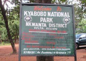
Kyabobo National Park
located in the Nkwanta district of the Northern Volta Region.
Kyabobo National Park (pronounced CHAY-a-bobo), a newly created Park in the Atwode traditional area, is located in the Nkwanta district of the Northern Volta Region. This park, which covers an area of 359.8 km,² is found in the Dry semi-deciduous forest zone and has both forest and savanna species of plants and animals. Its forests contain the nationally endangered endemic tree Talbotiella Gendtii.
The reserve was established in 1997. Ghana’s second-highest mountain, Mount Dzebo, is contained within the park and offers visitors an impressive view of Lake Volta. The National Park is recognized internationally as a unique mountainous conservation area with stunning views and well-protected wilderness.
Animals common to the park include Buffalo, Kob, Warthog, Aardvark, and Baboon. Threatened species of animals, with adequate protection, may recover, including Lion, Elephant, Bongo, Reedbuck, and Hartebeest, which may recolonize the Park from the adjacent Fazao National Park in the neighboring country Togo.
Animals common to the park include Buffalo, Kob, Warthog, Aardvark, and Baboon. Threatened species of animals, with adequate protection, may recover, including Lion, Elephant, Bongo, Reedbuck, and Hartebeest, which may recolonize the Park from the adjacent Fazao National Park in the neighboring country Togo.
The park offers challenging multiple-day hikes through its rugged terrain, mountain biking, game viewing hides, shrines, and sacred gro,ves as well as interesting cultural experiences.
The Two Breast Mountains
The Two “Breast Mountains” viewed from the Nkwanta Township are a welcome signal to the park. On top of these mountains, a panoramic view of the underlying plains, villages, and the Volta Lake offers the climbers a unique impression of the natural beauty of the park and other parts of Ghana. There are also camping sites in the park to suit the taste of lovers of nature and Eco-tourism.
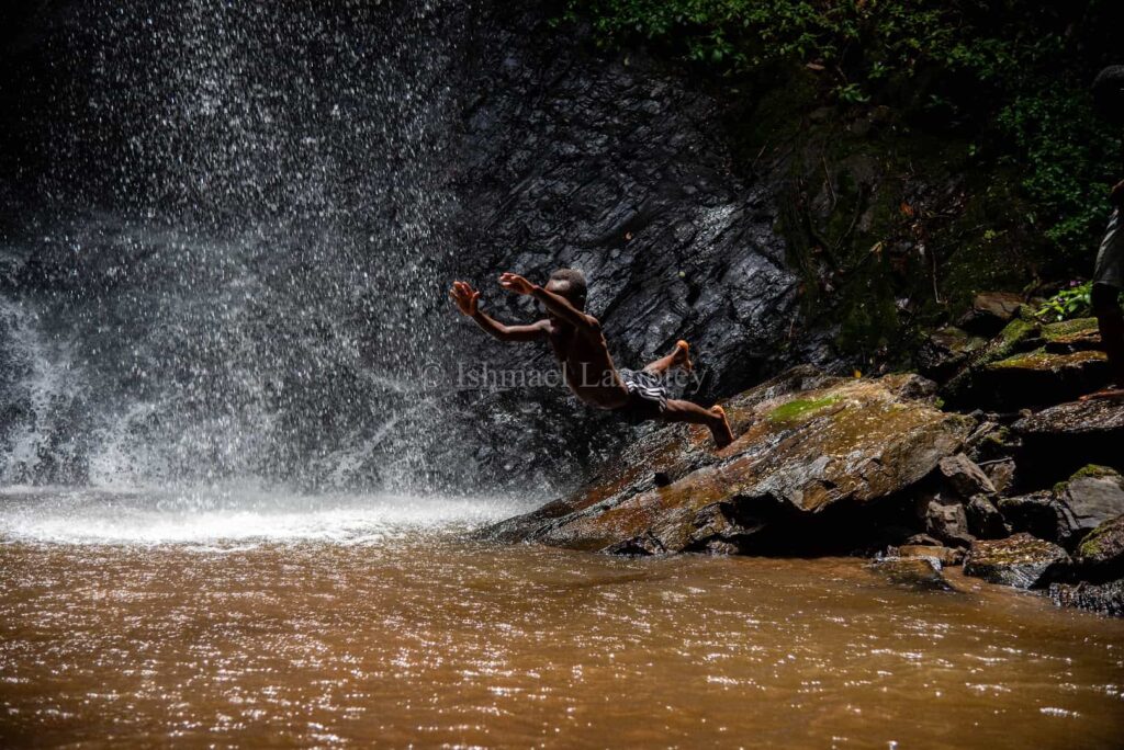
The Laboun Waterfall
Situated in Kyabobo Park, it is about 30 meters high. There is the upper fall and the lower fall and the accompanying singing of birds, shrills of monkeys, and cries of animals, and the forest canopy gives tourists a wonderful sense of satisfaction. The waterfall serves as the only source of water for the community, and it’s about 40 40-minute walk from the Shiare village.
The Laboun Waterfall
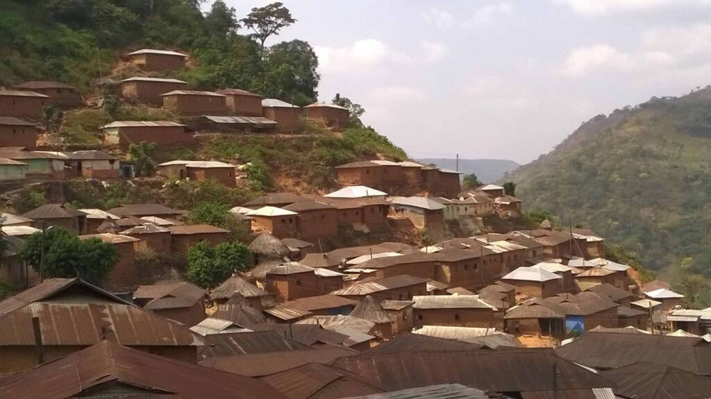
This village is over nine centuries old. Shiare is the paramount seat of the Atwode people and is affectionately called the ‘hanging village’ as a result of its architectural design. The houses are virtually built into the mountain, making them look as though they are hanging. The name ‘hanging village’ was given to them by Europeans due to how far apart they were from the rest of the people within the region many years ago. The Shiare people are predominantly farmers, and they produce natural honey.